|
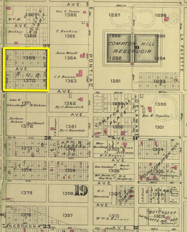
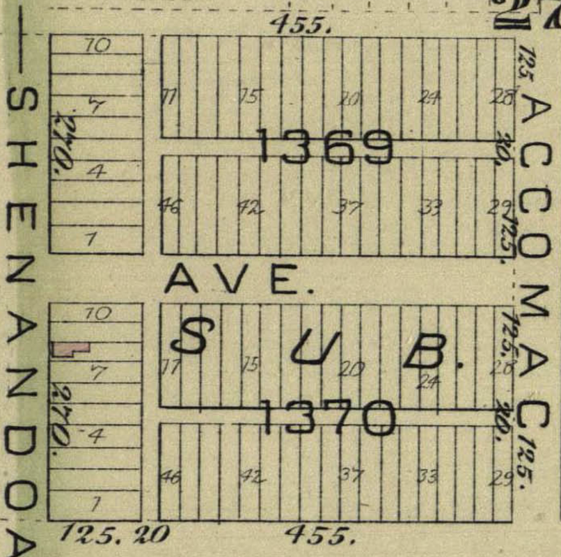
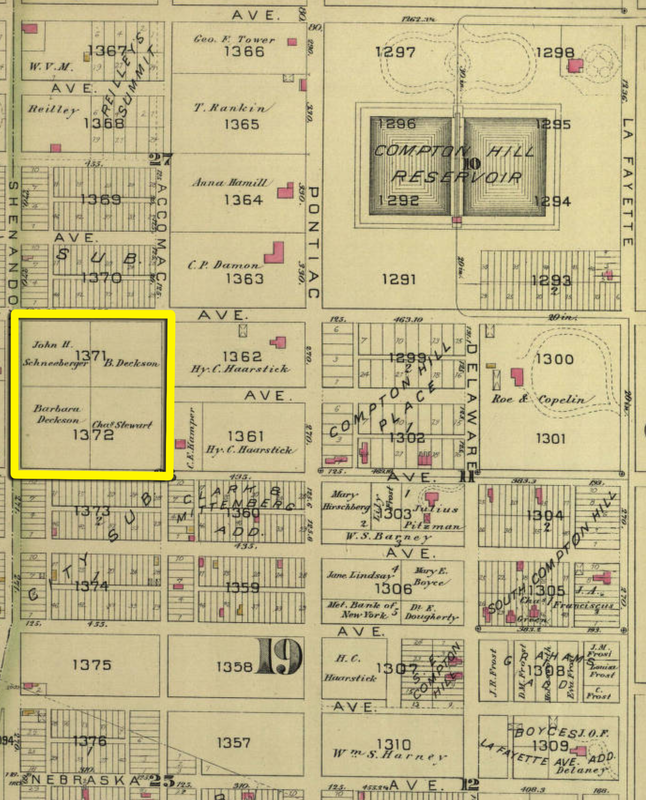
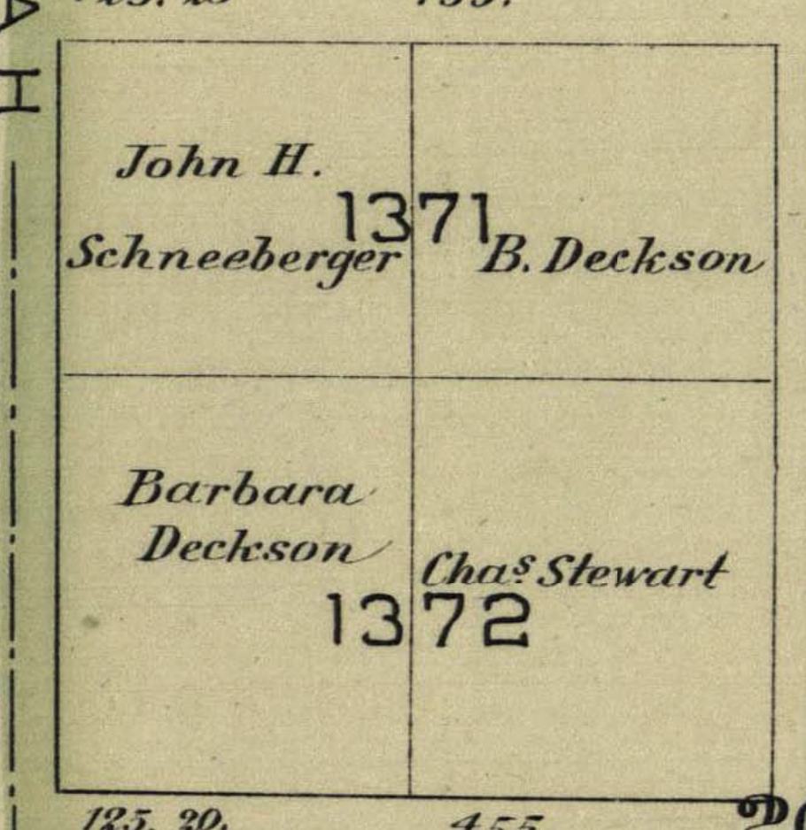
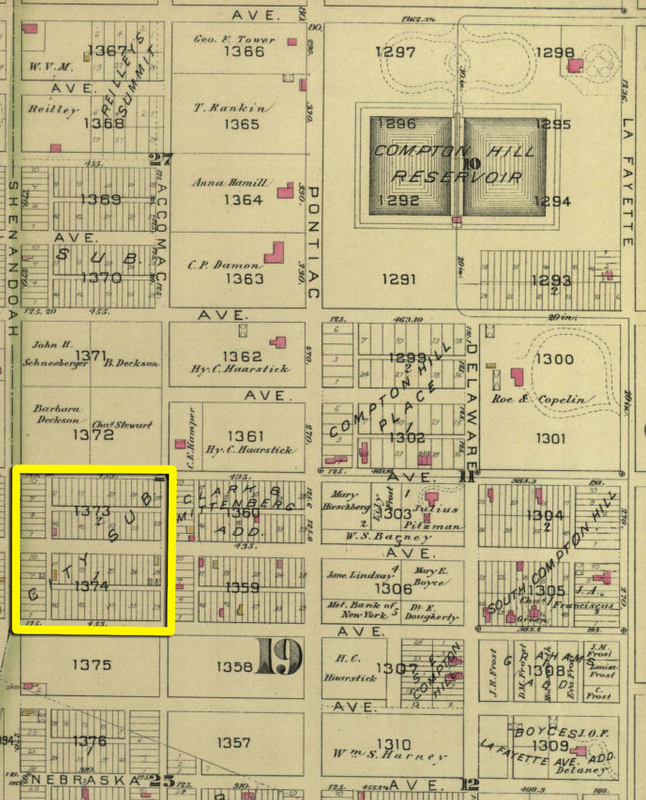
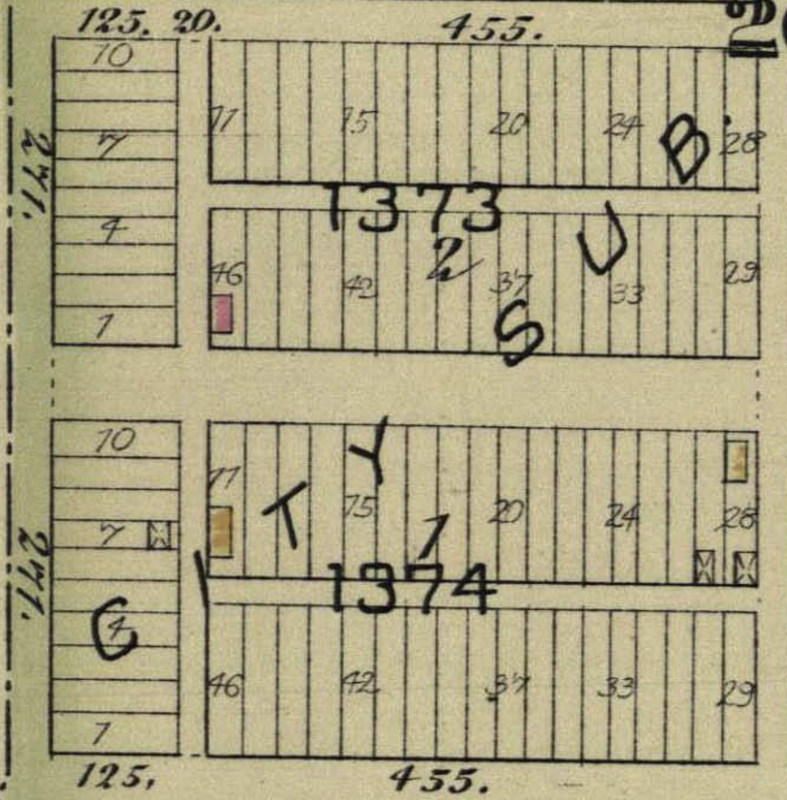
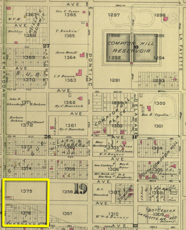
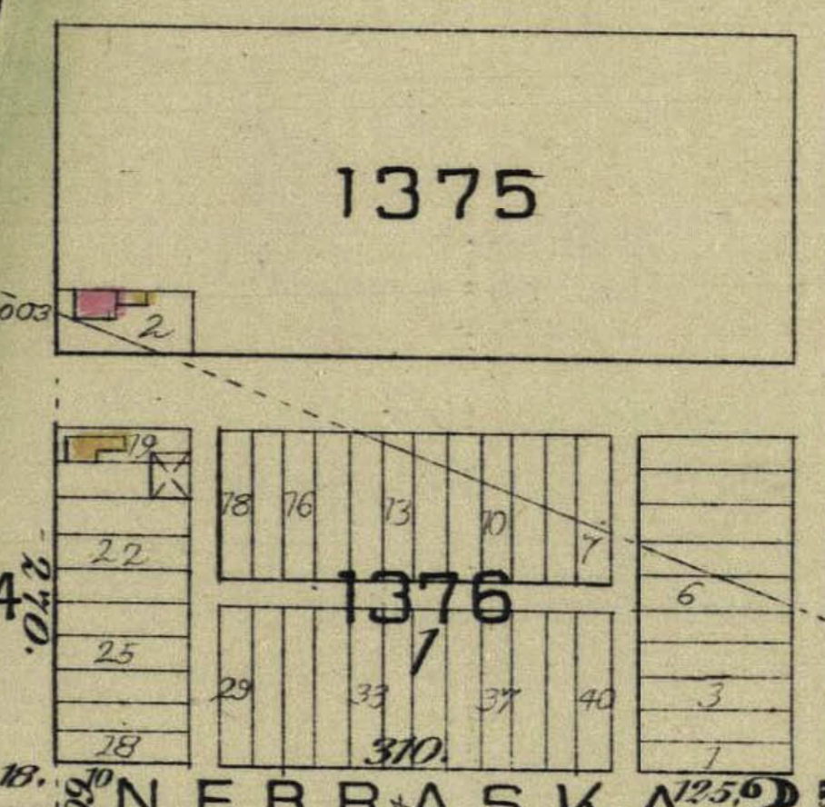
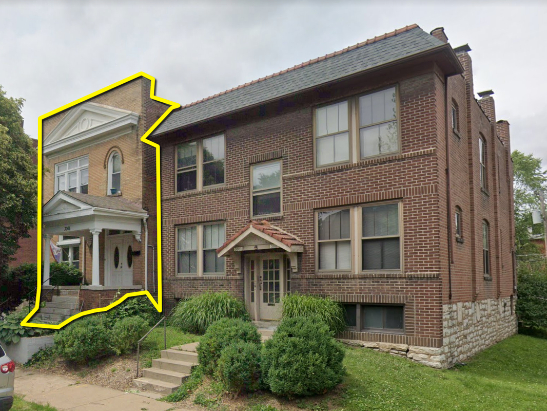
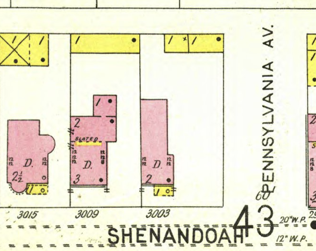
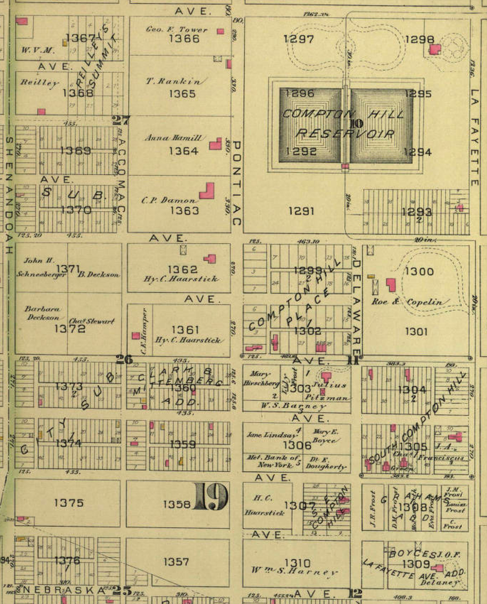
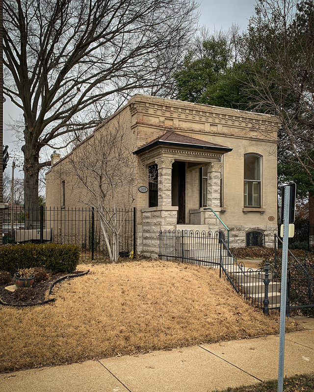
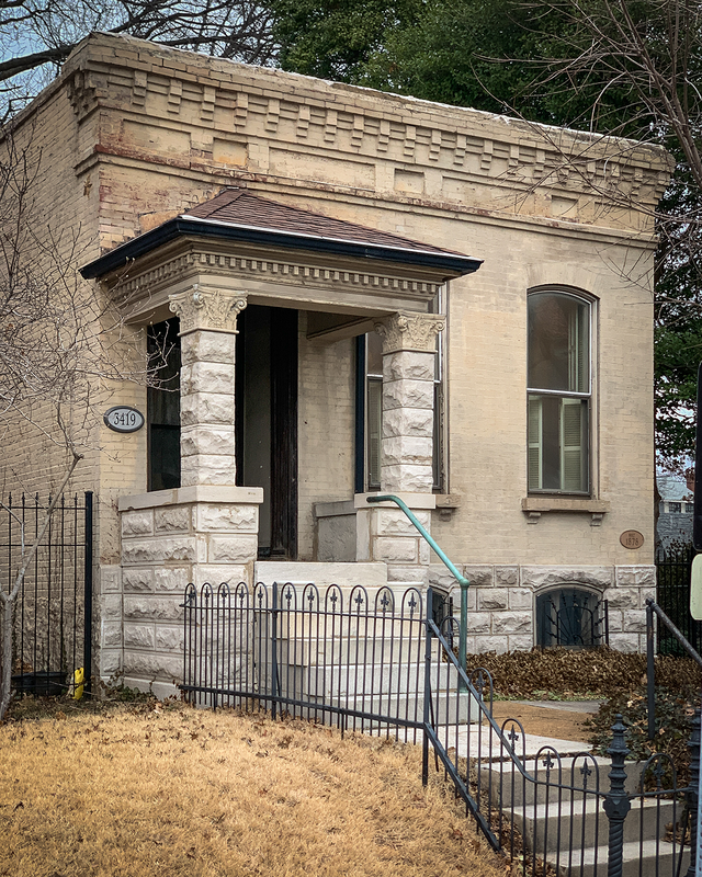
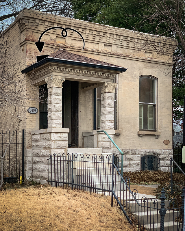
Last time I dug into blocks 1367 and 1368. This time, let's do 1369 and 1370. In that whole entire block, the 1883 map only shows 1 structure in existence, a tiny little brick (that's what the pink color indicates) building. Let's go ahead and skip it; it still stands today and I know the guy who owns it. 😉 Continuing down the map, blocks 1371 and 1372 contained no recognizable structures in 1883. It's hard to discern from the 1876 map if anything stood on that ground prior to 1883, but my guess is that the land was entirely undeveloped. That said, I was curious about the owners of the land. Were any of them noteworthy? Via a halfway quick and dirty search, here's what the 3 landowners were up to in 1883: John H. Schneeberger was a boot and shoemaker, operating a store at 310 Olive, right in the thick of things downtown. He lived at 1012 Winter Avenue, later renamed Morrison Avenue, in the Soulard area (LaSalle Park) and died in 1900. How he came to own a couple acres of undeveloped ground in Compton Heights is anybody's guess. I did my best to come up with something on Barbara Deckson, thinking it'd be easy since she'd stick out like a sore thumb -- there weren't a lot of female landowners in 1883 unless they married into wealth or inherited land from a wealthy family member. Unfortunately, there are literally zero records of ANYBODY named "Deckson" around that time period in St. Louis, let alone a "Barbara". Maybe the name is misspelled, or maybe information on her is lost due to the way records of females were kept back then: almost always referred to as Mrs. Husband's Name. Moving on to Charles Stewart, I figured he'd be tricky to pin down because of the commonness of his name. And he was; the records of the day show about a dozen people named "Charles Stewart" and there's no way to identify which one owned half of block 1372. So...another bust. Moving on to blocks 1373 and 1374, there were 3 dwelling structures in 1883, all along Michigan Avenue, and 2 sheds. The building on lot 46 of block 1373 and the building on lot 77 of block 1374, they both show up on the 1876 map but everything in both blocks was cleared between 1883 and 1900 to make way for Julius Pitzman's planned residential development. The last 2 neighborhood blocks along Shenandoah are blocks 1375 and 1376. The wood-framed house on lot 79 of block 1376, it' was gone by 1903. The house on lot 2 of block 1375...I don't know what to think. Block 1375 shows a small brick building with a wood-framed section on the back. Could have been a wooden addition, could have been a porch, who knows. The address for that particular structure, per the 1883 map, is 3003 Shenandoah; today it's 3005 Shenandoah on account of a multi-fam building being constructed on the lot between it and the cross street. I doubt the building still stands, but I can't find any records to verify or refute this. Here's what we know of the 1883 building:
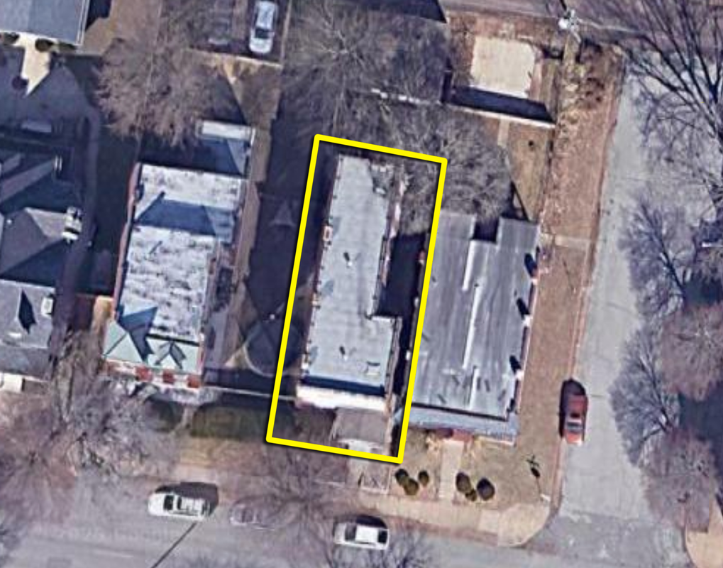
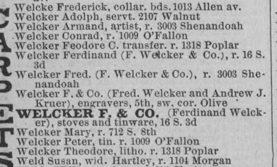
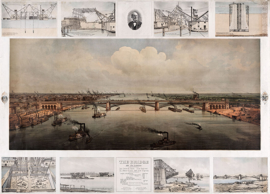
The city assessor says that structure was built in 1922. I disagree. That said, its architecture doesn't really scream pre-1922. From above, that structure, again outlined in yellow, looks like this: That shape looks an awful lot like the one called out as 3003 Shenandoah in the 1903 Sanborn map, which makes me pretty confident that the assessor's records are incorrect (they usually are, and are usually based off the oldest, most easily found building permit -- which could have been issued for any number of alterations to the structure). The building shape matches, the porch matches, and the listed number of stories ("2") matches. So far, I think we can conclude that the building dates to at least 1903, but let's keep going. When the Sanborn map was produced, 1903, the city directory shows its occupants as Armand and Pauline Welcker. Pauline's late husband was named Frederick; Armand was their son. Going back another 10 years - to 1893 - the city directory again shows the Welckers at 3003 Shenandoah. Going back to the 1883 city directory, same story, with a little added information. There were a couple handfuls of Welckers in the city in 1883, with Armand and Fred(erick) living at 3003 Shenandoah, presumably the same structure they lived in in 1893, and 1903, which per the 1903 Sanborn map is the building that still stands today. I can't imagine that they'd have occupied a different structure in, say, 1890, had it torn down, erected a new building on the exact same lot, and continued living at the same address. People didn't do that; if they wanted a different house they just moved. Based on the information gathered, I think it's possible that the subject building dates back to at least 1883, albeit with some major alterations. The 1883 city directory also gives us a little information about what Frederick and Armand did for a living. Armand was as an artist, while Frederick worked for F. Welcker & Co., listed elsewhere in the city directory in the lithographer category of businesses, as an engraver at the corner of 5th and Olive. Frederick died in 1887 but if one knows how to work the Google machine, much of his work is still visible today. For example, here's one (and probably my favorite) of his lithographs: Frederick's wife Pauline died in 1916 and about that same time, Armand falls off the map. No idea whatever became of him, but much like his dad, a lot of his artwork can be found via the Google machine. Anyhow...I'll call the building on lot 2 of block 1375 a "maybe". Maybe it's original construction was pre-1883, maybe it wasn't. Hard to say, given the available information. But, it's still kinda cool to see the artwork - today - of the people who lived in the house around that time.
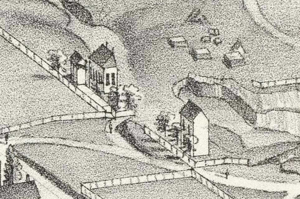
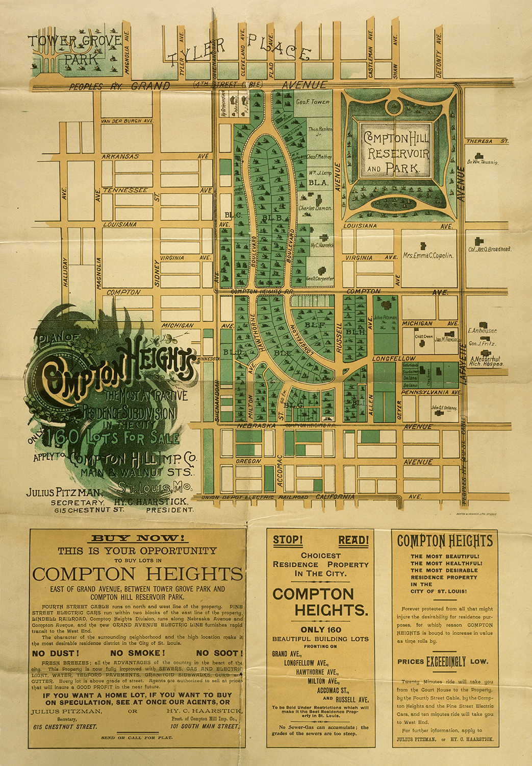
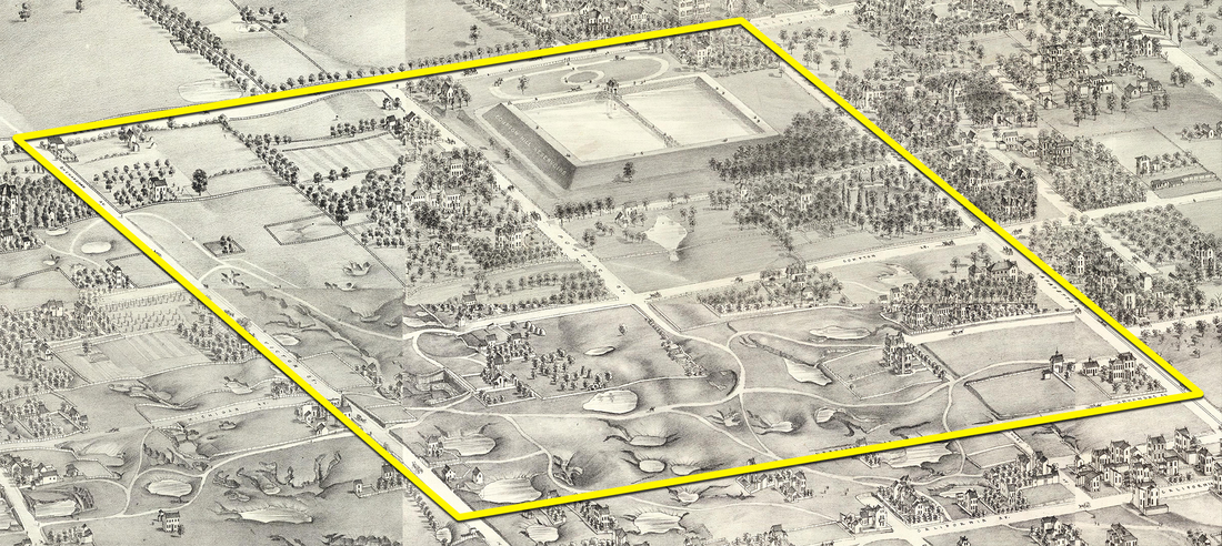
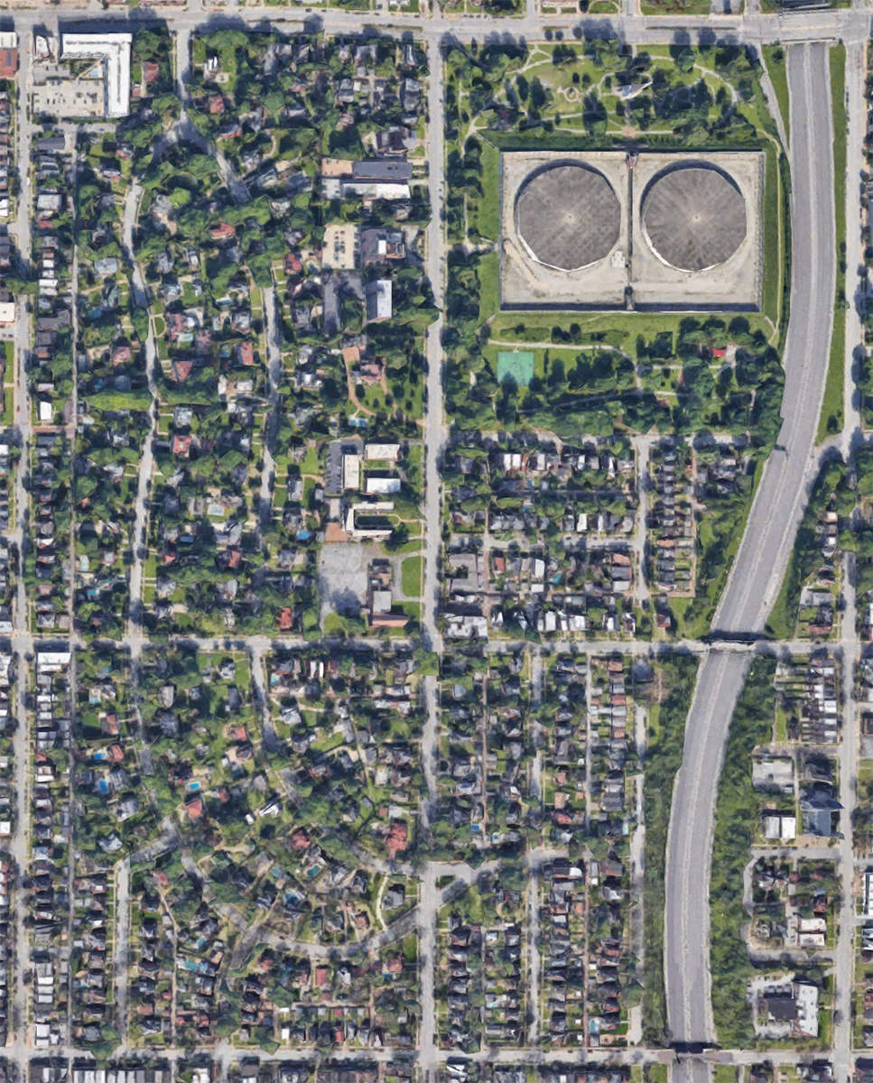
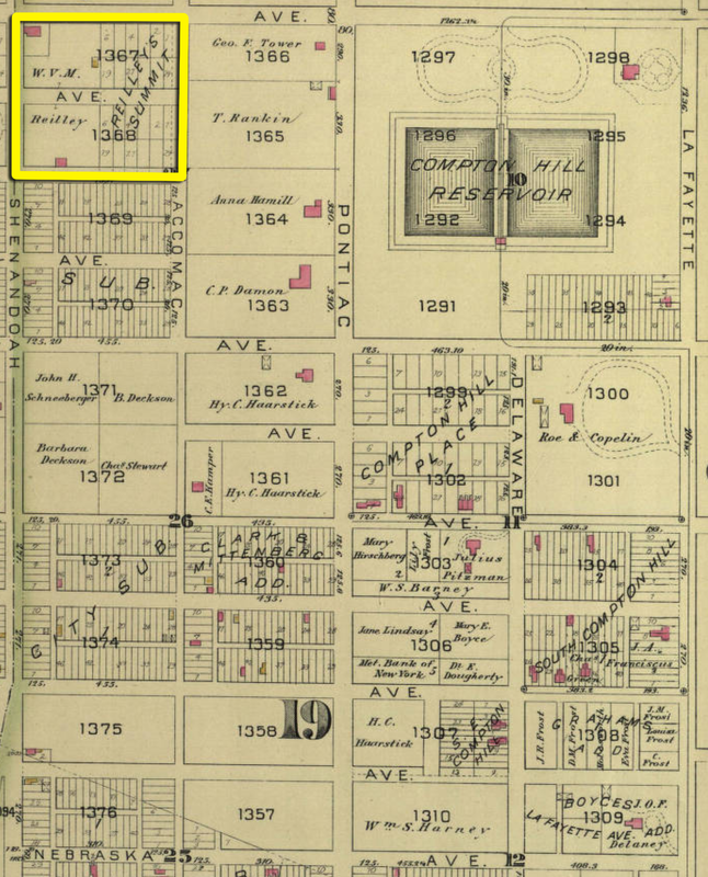
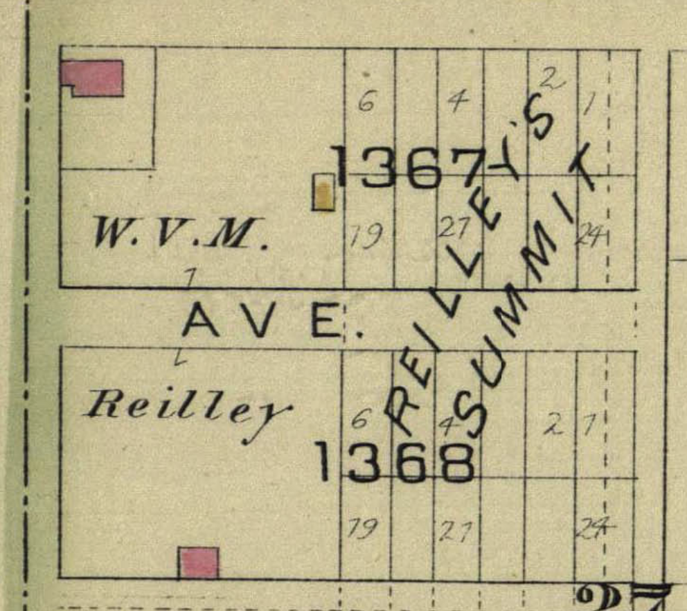
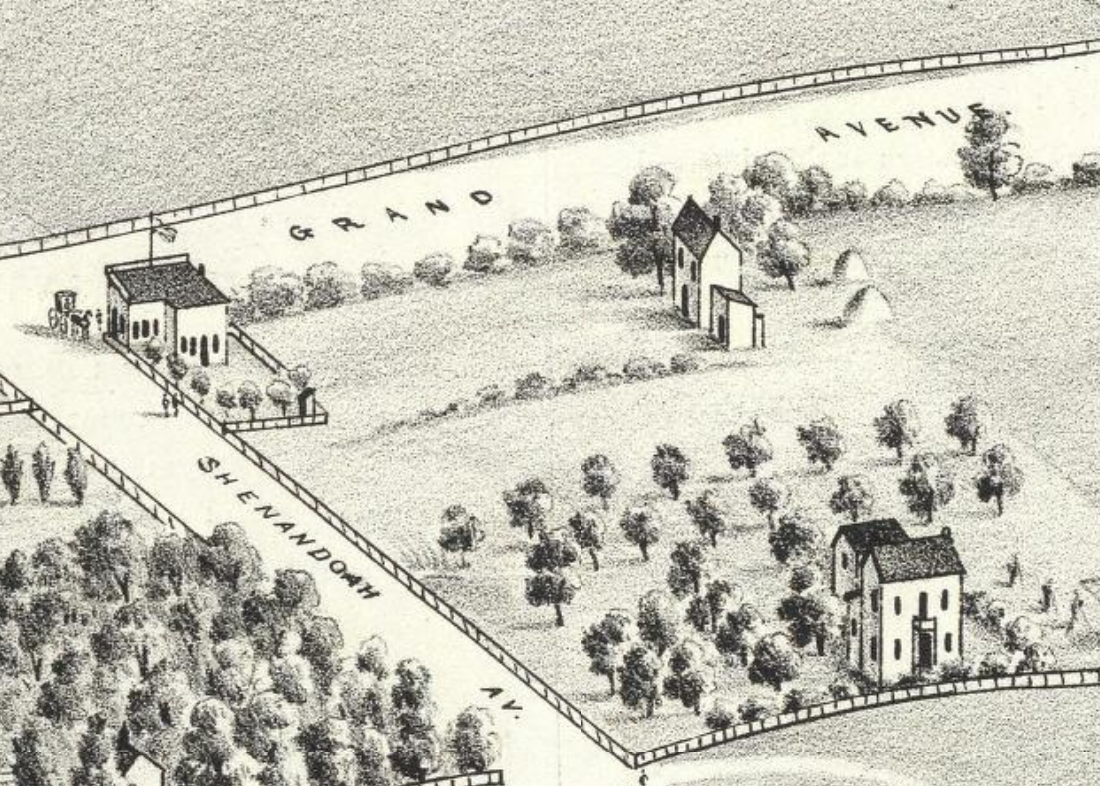
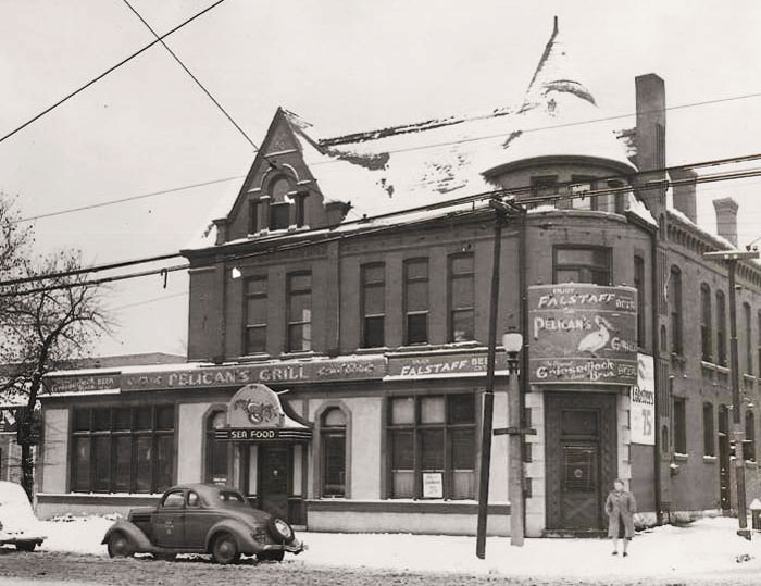
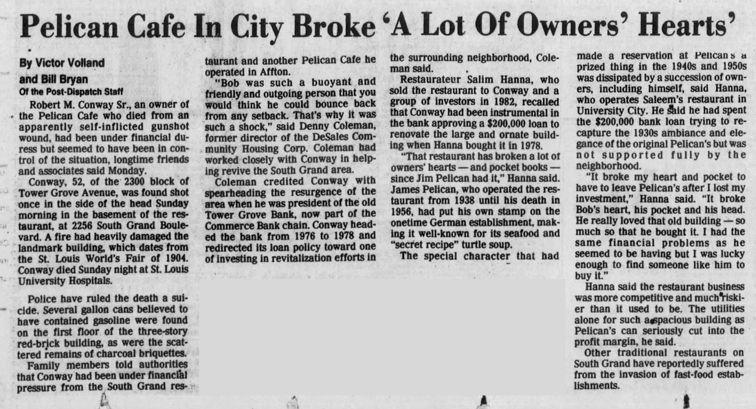
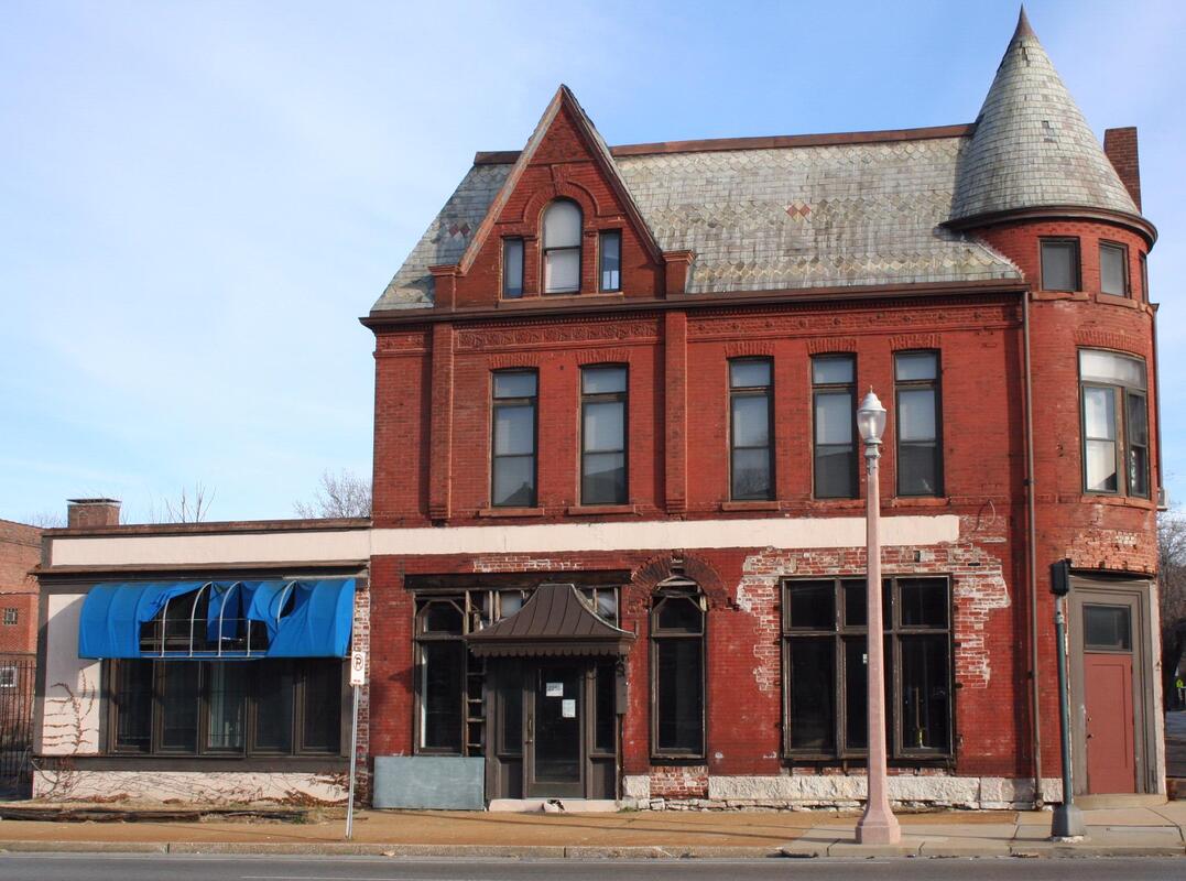
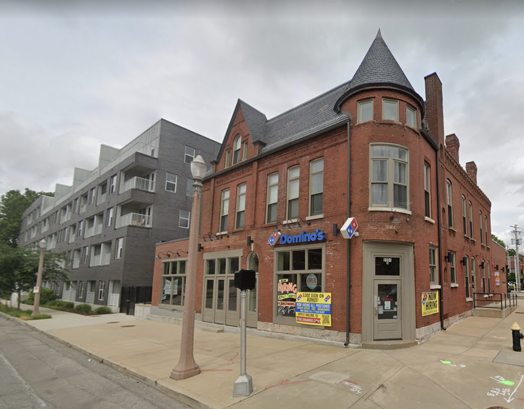
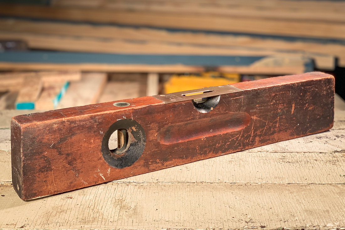
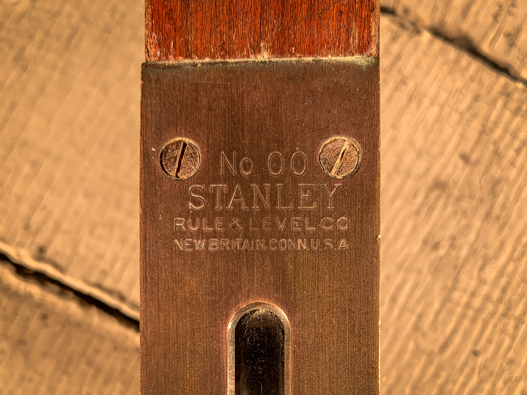
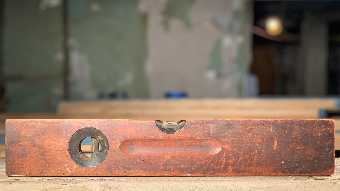
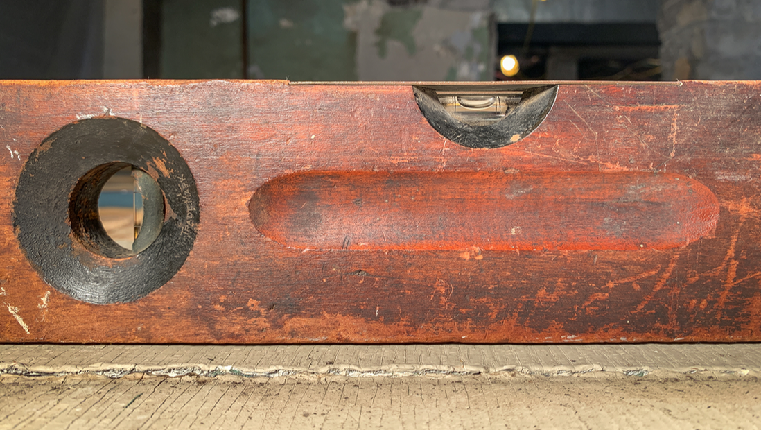
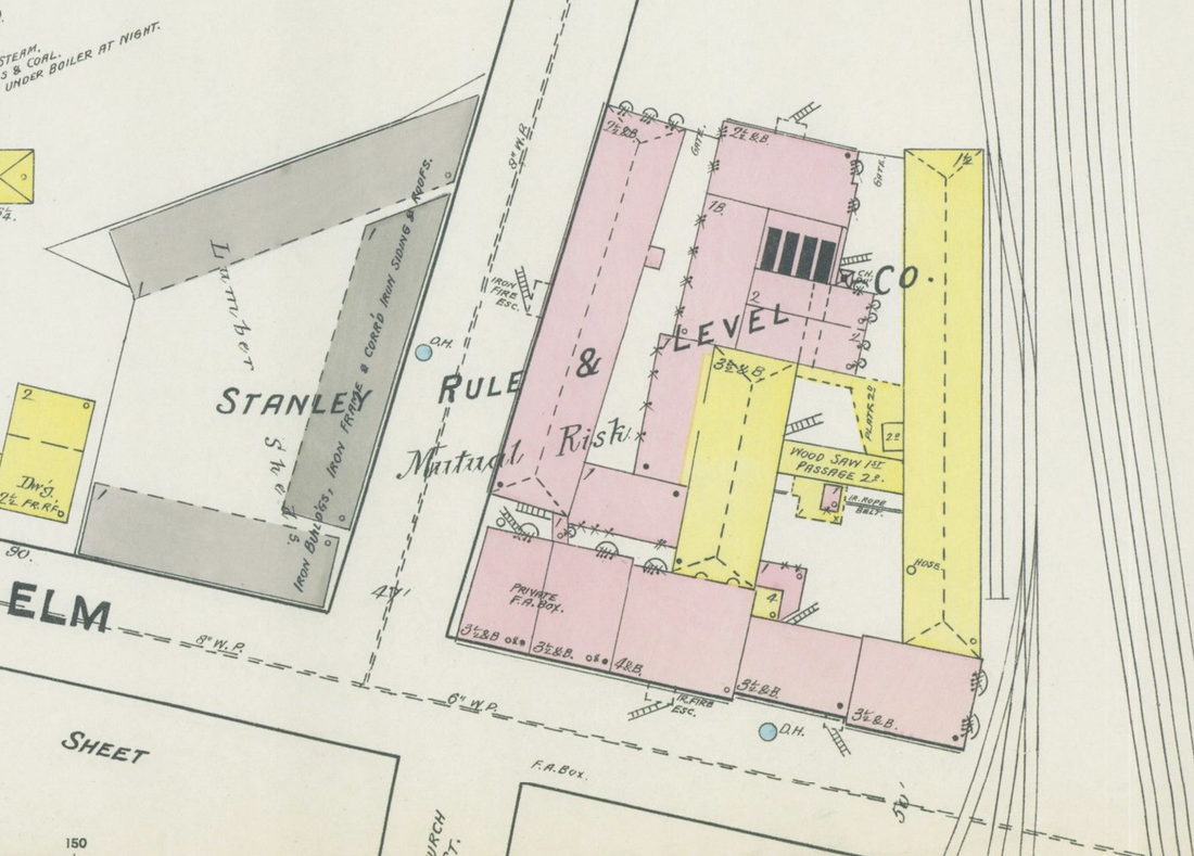
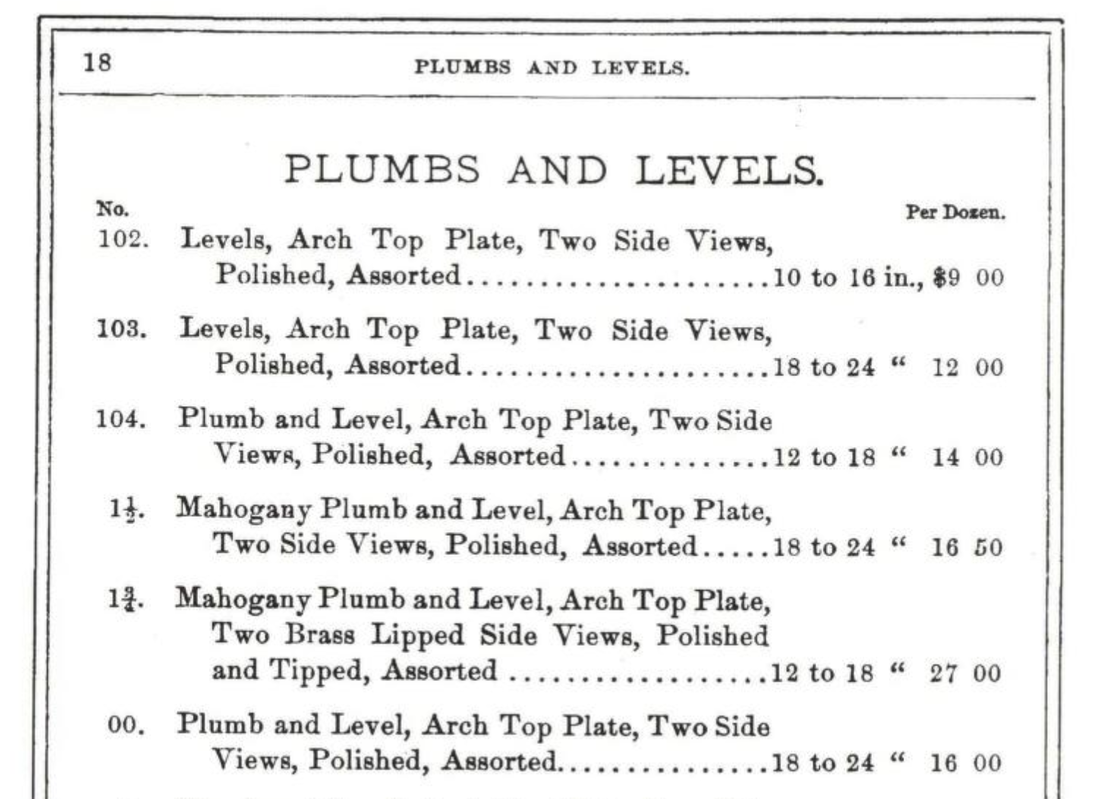
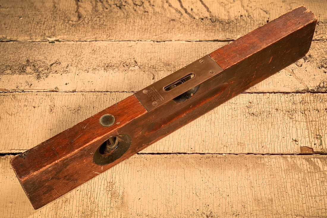
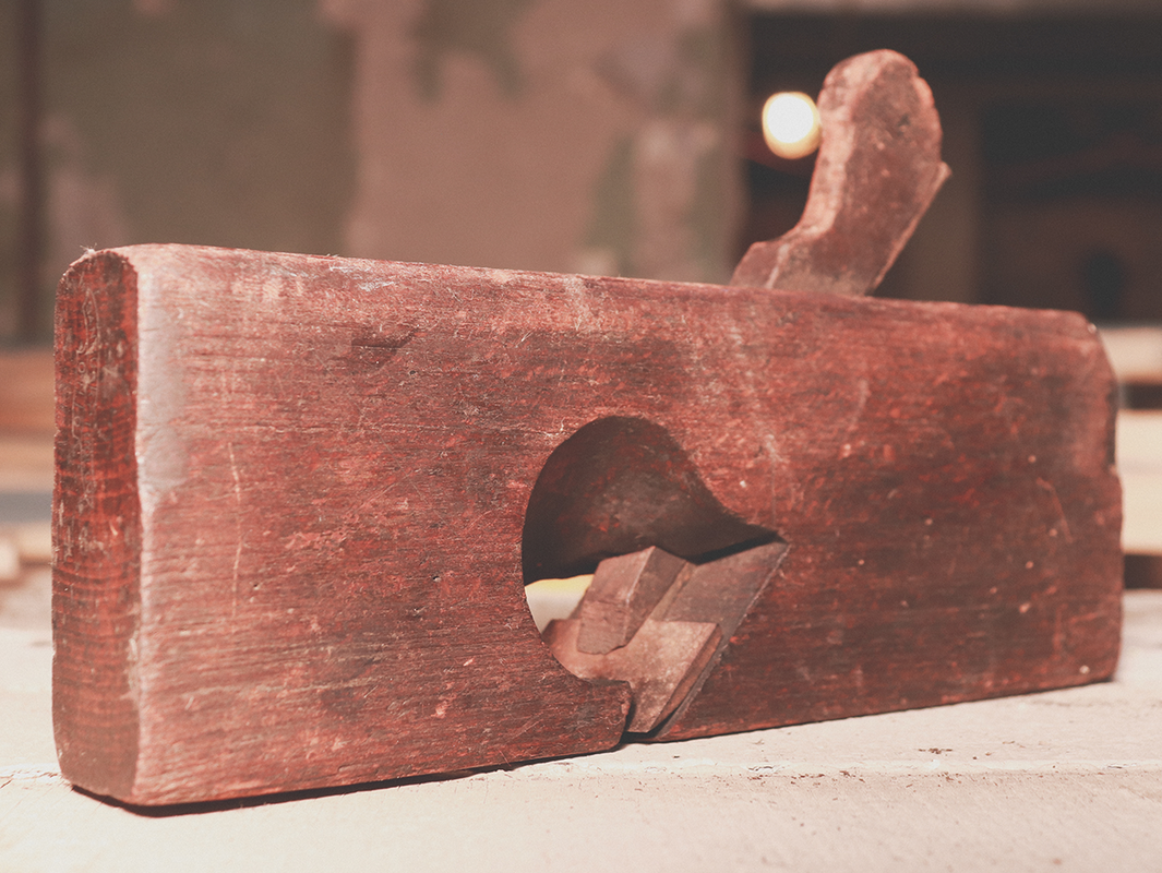
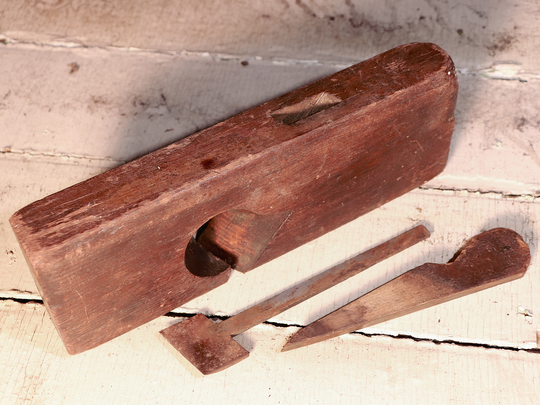
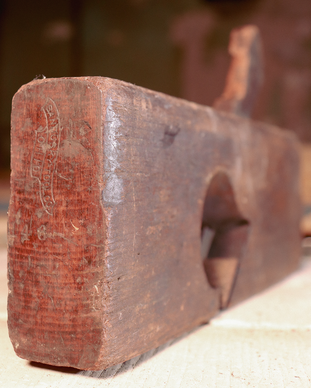
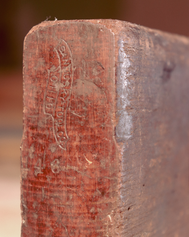
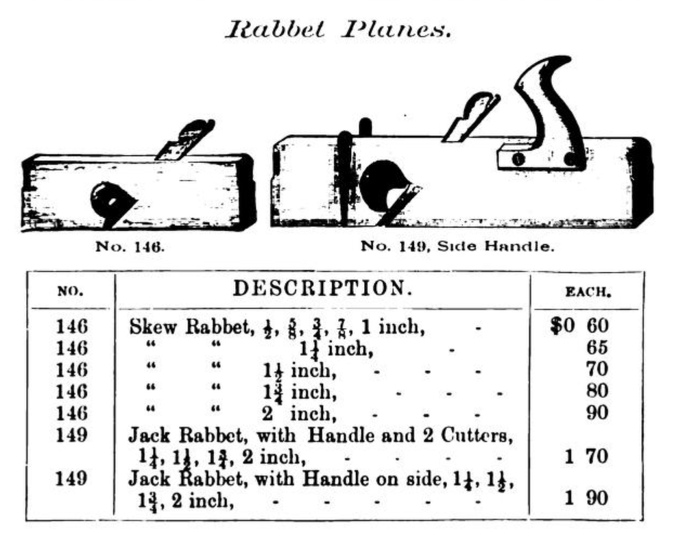
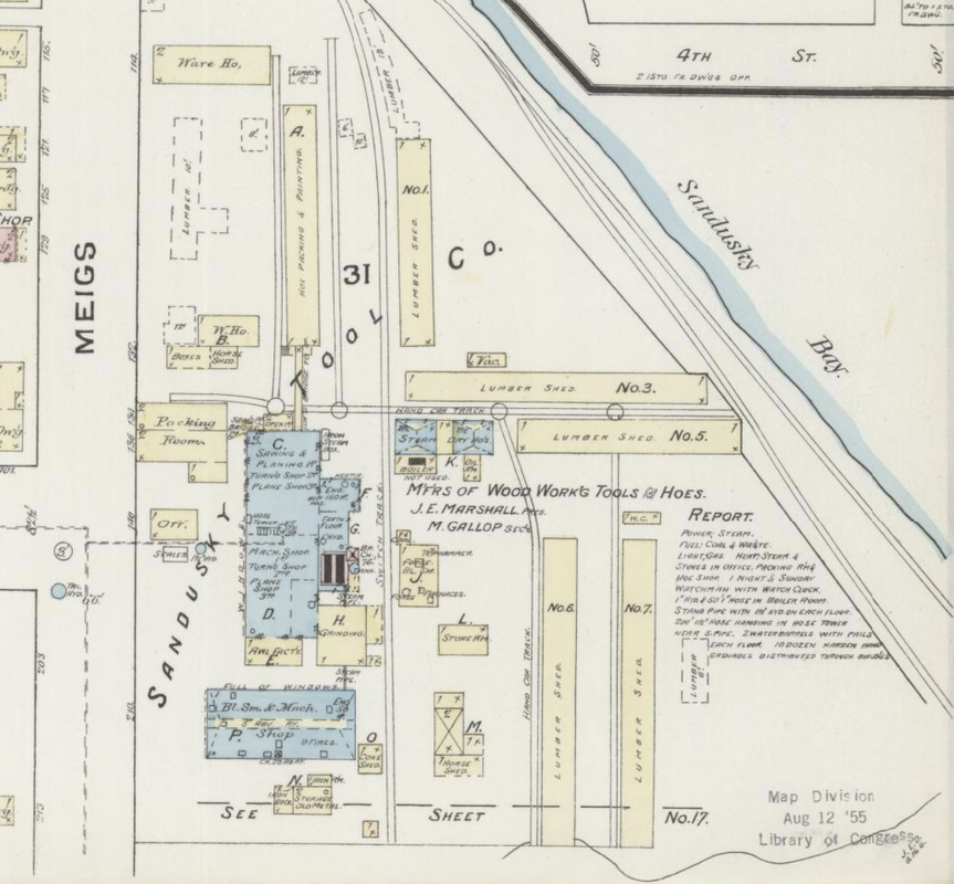
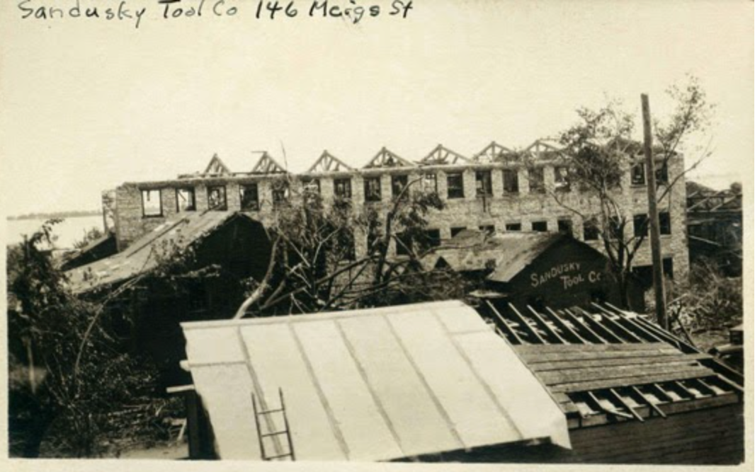
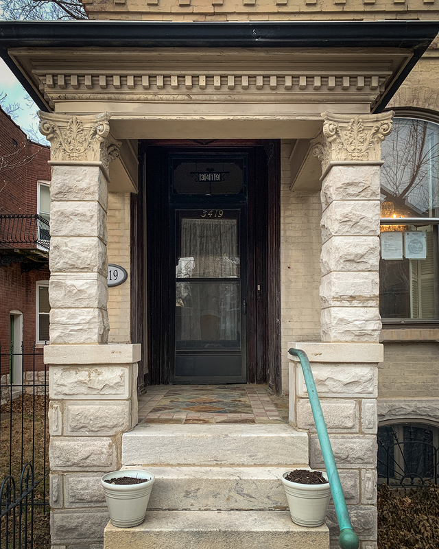
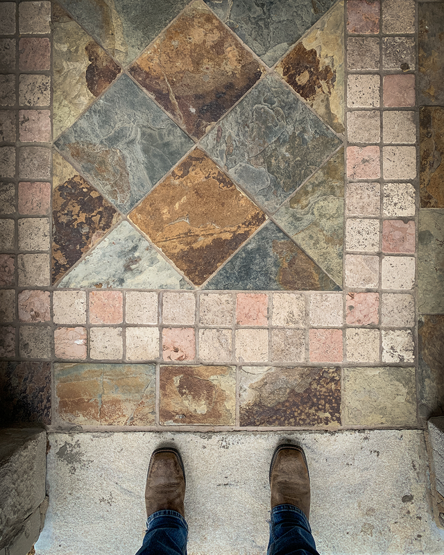
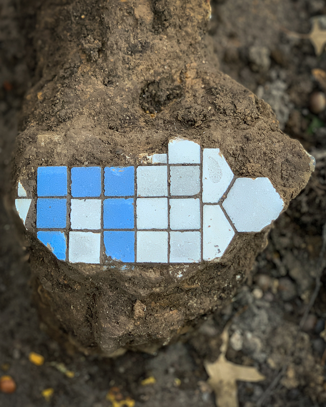
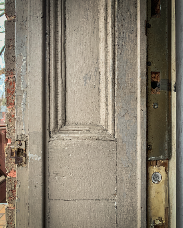
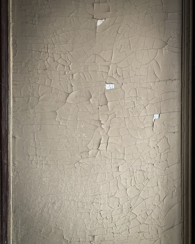
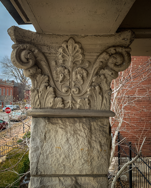
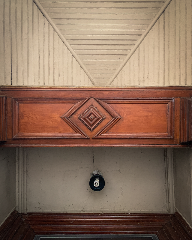
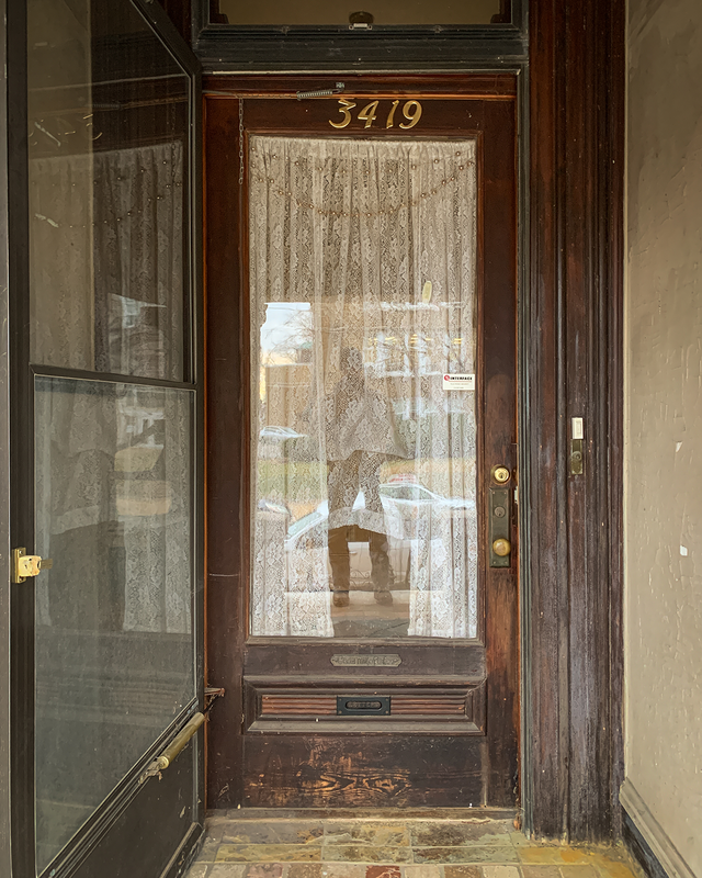
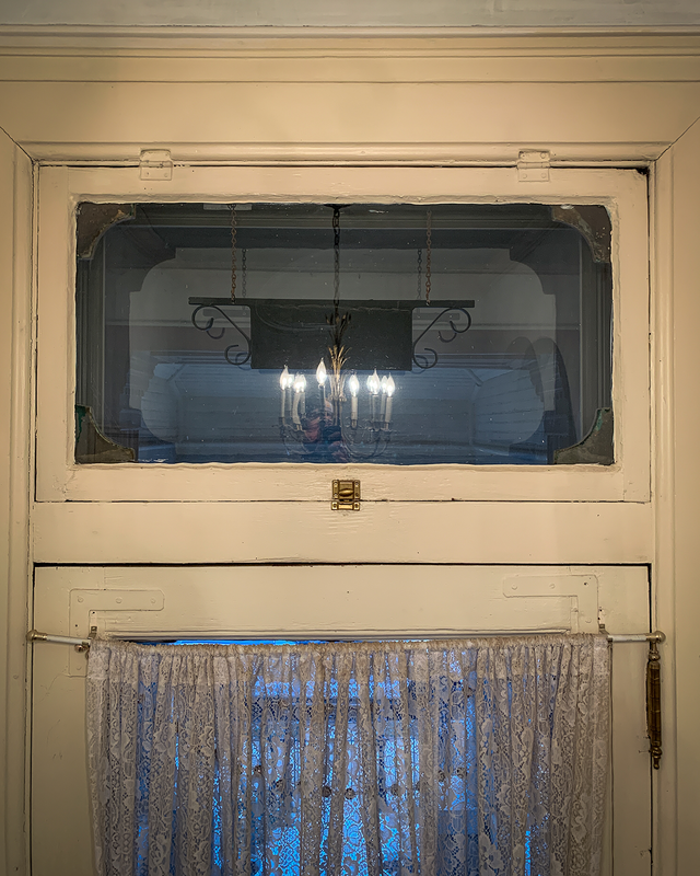
It's too cold to do much of anything rehab-related on the outside of the house, I don't have any projects currently planned for the house's interior, and I just started a new job - always a little chaotic - so there isn't much to talk about as far as the house goes. But the other night I went down a wild internet rabbit hole and got kind of fixated on old pics of local houses, which turned into wanting to really investigate what remains of the neighborhood's building stock dating back to 1883. As such...here we are. I live in a neighborhood called Compton Heights, which is more or less defined by Grand Avenue, Lafayette Avenue (in 1883; now I-44 is the border), Nebraska Avenue, and Shenandoah Avenue. In 1876, per the Compton & Dry Topographical Survey, this area was home to the water reservoir and a few large houses but was still relatively undeveloped. By 1883 the area had been somewhat platted, although the platting changed to accommodate the curvilinear section of the neighborhood, which was way ahead of its time. I-44, completed in the early 1970s, eliminated several neighborhood blocks. During the early days of St. Louis' rapid population expansion the area was highly desirable due to its proximity to the city's central business district while still being a safe distance from downtown's industrial activity, and the vast majority of the neighborhood was developed between 1890 and 1910. But what remains from 1883? And what existed back then that no longer exists now? That's what I want to take a look at. Using the 1883 map - the 1876 map is a lot cooler to look at but because the area was still so undeveloped it takes forever for me to figure out house addresses - I'll go block by block and see what I can come up with. Starting in the upper left corner of the 1883 map, there were 3 structures shown in blocks 1367 and 1368. All 3 structures appear on the 1876 map, and look like a small commercial building and 2 small homes. The 2 houses were gone by 1903, and weren't notable enough for their to be any easily accessible record of their history. The structure on the corner, however, was significantly added onto in 1895 by the Griesedieck brewing family and still stands today. Amongst local history aficionados the structure, seemingly an eating/drinking establishment since it's initial construction, is primarily known as the home of "Pelican's Grill", a restaurant operated by James Pelican (born Demetrius Spiros Pelekanos) from 1938 - 1956, and until 1975 under different ownership. The building was listed as a city landmark in 1976, although it fell on hard times for several decades afterwards, including a fire intentionally set on the first floor in 1985 by the building's financially distressed owner, who then committed suicide in the building's basement. Several years ago the building was rehabbed and now has new life as a Domino's Pizza on the 1st floor, with a large apartment building fronting Grand just to the north. A coffee shop is planned for the empty storefront space between Domino's and the apartments, but given the Starbucks 2 blocks to the south, it'll be interesting to see if that development pans out. So...the building at the corner of Grand and Shenandoah definitely predates, albeit with major alterations, my house's construction in 1878. I doubt more than a handful of existing neighborhood buildings can say the same thing, but this is 1 that can. Another piece of grandpa's collection I now get to call my own, a vintage Stanley No. 00 level. Based on the trademark detail stamped in the brass plate on the top of the level, I think it was made between 1886 and 1890 by, obviously, the Stanley Rule & Level Co. The Stanley Rule & Level Co. was founded in 1857 in New Britain, Connecticut, by Henry Stanley. The company made all sorts of carpentry tools and by 1890 the Stanley Rule & Level Co.'s plant was a fairly sizable operation: In 1920, the company merged with the founder's cousin's company, Stanley Works, and is still around today as Stanley Black & Decker. Unfortunately, the Stanley Rule & Level Co. plant was demo'd in the 1960s or 1970s like so many other large, urban brick structures. We'll save a conversation on the reason(s) why for another day. 😉 Anyhow, if my date guesses are correct, this exact level originally cost somebody under $2 to purchase. Pretty cool find. It's obsolete, on the one hand, given its wooden body. On the other hand, I'm willing to bet that the bubble gauges are both still dead on, and I can't tell you how many modern, metal levels I have where 1 bubble says 1 thing and another bubble 18 inches away says something slightly different. This was a well-built tool and cared for by the people that owned it. I'll clean 'er up a little bit and then find a nice spot to put 'er on display. My dad recently dropped off some more finds from the clean out effort at grandpa's house, including this, a relatively old skew rabbet plane: What's a skew rabbet plane? Let's split up the term to make this real simple. A plane is a wood-shaving tool. Long, wide planes are used for flattening lumber. Short, slender planes are used for edge or profile work. And, there's a whole world of planes in between that are, essentially, general purpose. Nowadays most plane bodies are made of metal but way back when they were made, exclusively, of wood. A rabbet is a woodworking term used to describe a channel or recess cut along the edge of a piece of material. These are commonly confused with dados, which are the same thing but in a different location in the material. Skew means some angle that isn't parallel or perpendicular to a reference line. In this case it's referencing the angle of the cutting edge of the plane iron, which sits a little cockeyed relative to the plane body and allows for cleaner, more controllable work than if the plane iron were square to the body. So...a skew rabbet plane is a woodworking tool that's used to cut a little channel along the edge of a piece of wood, and 100+ years ago would have been prevalent in the construction of picture frames and casework, stuff where precision and detail were critical. To the casual observer this may appear to be a homemade tool, like something somebody crafted in their basement or garage. But it's not; it was made sometime between 1869 and 1929 by the Sandusky Tool Company in Sandusky, OH. It's legit. Aside from the Sandusky Tool Co. name, the plane is also stamped with the number "146", clearly identifying it - per an 1891 product catalog - as a skew rabbet plane. My (grandpa's) plane happens to be the 1-1/2" variety. What do we know about the Sandusky Tool Company? They were located on Lake Erie at the very northern tip of Sandusky, OH, operated until 1929, and produced a variety of hand tools serving the carpentry and agriculture industries. Per an 1888 book detailing Sandusky's industrial giants, the tool company employed several hundred people and brought in hundreds of train car loads of wood each year for use in the construction of various tools and tool handles. The plant covered 5 acres and by 1905, apparently, was producing 75% of all the wood body plane irons sold in America. Unfortunately for Sandusky Tool Co., several things worked against them in the early part of the 20th century: the agricultural hand tool market was drying up as mechanization took over, the company failed to transition to more metal-bodied planes like their competitor, and recovering from the devastation of a 1924 tornado proved to be an insurmountable task. The tool company was purchased by a competitor in 1926, and the "Sandusky Tool Co." name disappeared around 1929. But...if one digs through enough dusty boxes of stuff in their grandpa's basement...it's very possible to find a tool keeping the company's name alive. Last year I jumped into the middle of the #52weeksofhome photo challenge, created by @amyleigh_1902victorian, although I didn't do a very good job of sticking with it. This year, I'm going to give it a better effort. 2023's week 1 theme is "welcome & entryway". So...here's my house's primary entrance: What if I told you that this little porch - which desperately needs a pretty healthy do-over - is NOT original to the house? 'Cause it's not. Here's how I know: 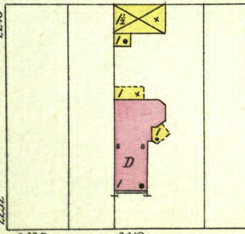 1903 Sanborn Fire Insurance Map 1903 Sanborn Fire Insurance Map 1 - The 1903 Sanborn Fire Insurance map clearly indicates covered porches at the rear and side of the building as well as 2 detached structures, but no front porch. These maps got an astounding amount of detail correct, which makes me trust them when it comes to historical research. As of 1903, this house did NOT have any sort of front porch. 2 - For those of you local to St. Louis, you may not have paid attention to it but these old houses with recessed entryways, 99 times out of 100 they did NOT originally have covered porches. Drive around and look; front doors in line with the front facade got covered porches, front doors recessed from the front facade - like my setup - did not. 3 - If you stand out in the street and west of the house, the old arched brick entryway is still (barely) visible just above the porch roof. That arch was the original setup. There would have been a set of stairs - maybe wood, maybe stone - up to that arched opening, then a tile floor, maybe some paneling on the side walls, a few feet of cover, and the recessed front door. Sometime in the 1910s or 1920s, somebody really put some money into the house. By 1910 the house was already 30+ years old and if the house still needed to be updated with electricity and indoor plumbing, somebody - I think it was the dentist that lived here - probably figured they may as well do it up. That's when the brick auto house (garage, in modern terms) was built, replacing the original wood structure. And the cast iron fence was added. And the basement received a granitoid finish on everything. And this porch, I think it was probably added then as well. That's the porch's history, or at least what I think is the porch's history. When I get around to redoing the parts that need redoing, maybe I'll learn more. Until then, here's what the porch consists of: The current floor is this nasty slate tile, installed in the 1980s. However, I've found chunks of old floor tile buried in a couple different spots in the yard. I can't prove that the old blue and white tile came from the porch but it 100% could have, and would certainly be period-correct for the 1910s or 1920s. Some day that slate will be replaced with something like what would have been there originally. Then there's the side panels, which are sort of intriguing. Originally, like even before the porch, the little wall spaces between the front door and the front facade would have most likely been covered with some type of wood paneling. For example, the back door still has its original millwork on the exterior side of the door jamb. The front porch side panels would have looked something like that. I suspect that when the porch was added, or maybe even later, whatever was there originally was covered up. Currently, there's some sort of almost drywall-like sheet material on the sides of the recessed opening. The paint is cracking and the sheet material has some give to it, like it was either mounted on furring strips or existing paneling. As much as I want to hold off on the front porch for a couple years...curiosity may get the best of me and I may poke some holes in the side panels to see what, if anything, may be hiding underneath. I would be super, super excited to find the original paneling...but I'm not getting my hopes up. Up top, there's the capitals, millwork, and ceiling. I don't really like the capitals - they're Corinthian, sort of a Greek Revival architectural style - because they don't mesh with ANYTHING on the house architecturally, but they were pretty common for one reason or another 100+ years ago and they are what they are. The millwork is relatively ornate but out of whack symmetrically, either because the design was a little off or the construction dudes weren't all that good. Like, the porch roof midpoint doesn't line up with the wall opening midpoint, and that doesn't line up with the floor midpoint. But again, it is what it is. The structure is in place, no changing it now. That said, something really has to be done about the lighting situation, and the space between the transom and front facade in general. Right now it's a cobwebby dead space and none of the trim or surface coverings make any sense, which makes me think this was the space that became hard to deal with design-wise once the porch was added, and everybody involved kinda threw up their hands and just ignored it. I will ignore it too, for now. But not forever. And lastly, there's the door and transom. They're correct for 1878 construction based on architecture, construction means, methods, and materials, and wear and tear but it's hard to 100% verify that both are original. The exterior side is pretty gaudy with the ugly brown aluminum storm door and transom cover, and on the interior the only thing I've done since I moved in was raise the center drape a little so the dogs - both strongly qualify as the "guard dog" variety - could see through the glass. Otherwise, I haven't touched ANY of it, all of it was like that when I bought the place, 3 sets of house numbers, 2 doorbells, 2 deadbolts, and everything. I really like operable transoms. The one over the back door is hinged on the side, but the front door transom is hinged at the top and I wonder how it would have been kept open back when transoms were critical for airflow through a house. Anyhow...that's the front porch and primary house entrance. Someday I'll get around the makin' it all shine like it did 100 years ago... |
Archives
July 2024
|
